The history of human habitation of this area of Devon can be traced back more than 10,000 years to the Stone Age. Looking southwards from the towpath near Rock Bridge it isn’t hard to imagine that way back in the mists of time a small group of people wandered across a hilltop and then stopped to gaze in awe at what they saw. Laid out before them was a huge area of gently undulating land crossed by rivers and streams and bounded to the north, west and east by rolling hills rising to over 800 feet above sea level. The soil in the area was highly fertile, thanks to the underlying bedrock of red Permian sandstone which was laid down 280 million years earlier, when the area had been a desert . A constant supply of fresh water, shelter, fertile land and truly excellent views; what more could anyone ask for?
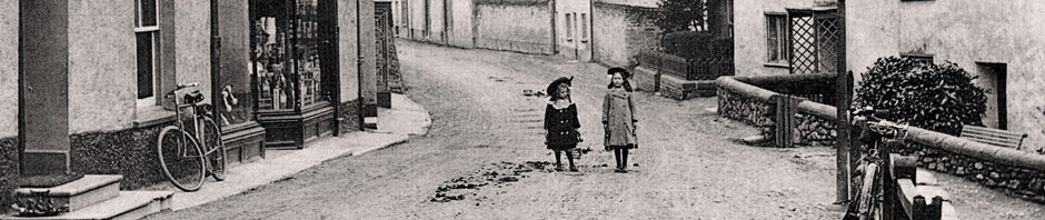
Today, wherever you look in Halberton, you will see how changes in society have left their mark.
The natural landscape became a managed landscape as a result of farming. By 1,500BC the process of enclosing land to create fields was under way. By the middle of the Iron Age the lowland areas of Devon had all been extensively cleared of woodland and the expansion the land area used for farming continued during the Roman and Anglo Saxon eras. The open field system was widely in use by the time of the Norman invasion (large fields were divided into strips which were allocated to individual families, retained for communal use or reserved for the sole use of the manorial lord). A few remnants of the local strip fields were recorded in the 1838 Tithe Map of Halberton, for example to the north east of Battens Farm. Later, particularly during the period from 1200 to 1400, most of the strip fields were enclosed into larger parcels of land more closely resembling the farmland that is so familiar today.
The built landscape that we see today developed over millenia; here are but a few examples. The Domesday Book (1086) records the existence of several farms in Halberton that are still in situ. At the time of the Norman invasion in 1066 an Anglo Saxon church probably existed on the site now occupied by St Andrews. You will find is a lot of information about St Andrews and photographs on the Devon Churchland website. In 1539 Halberton priory (now a private dwelling) was closed after more than 400 years and the last two Augustinian monks left Halberton village. The Grand Western Canal opened in 1814. The Methodist chapel was built in 1816. The railway halt opened at Halberton in 1927. The North Devon Link road opened in 1989.
The parish of Halberton as we know it now (one of the largest in Devon in terms of geographic area) has a total population of over 2,000 people with around 900 living in the village itself in about 350 households. Only about 80 people (9% of the working population) work in Agriculture and Forestry; a massive reduction in numbers since early Victorian times. As jobs working on the land disappeared they have been replaced by work in the wholesale and retail trades, education, health and social work; these days almost 40% of all working people in the parish are employed in those trades. The results of the 2021 census for Halberton are available if you click here. If you prefer information displayed on a map click here.
In 1990 most of the village of Halberton was designated as a Conservation Area; an area of ‘special architectural or historic interest’.
![]() This PDF copy of the conservation area report of 1990 includes sections giving an excellent introduction to the history of Halberton.
This PDF copy of the conservation area report of 1990 includes sections giving an excellent introduction to the history of Halberton.
There are 64 listed buildings in the parish, two of them Grade 1 (St Andrews Church and Moorstone Barton). You can get a full list of them all with a map and further details if you click here.
The Devon and Dartmoor Historic Environment Record lists all of the the known archaeology and historic environment for the county of Devon, including Dartmoor National Park. To see the lists for Halberton, click here, enter Halberton in the search box. Select ‘Devon and Dartmoor HER’ from the lists (then view all results). You can see the results on a map produced by Devon County Council; click here and follow the instructions.